Lower Rancheria, California
From Wikipedia, the free encyclopedia
38°26′17″N 120°49′10″W / 38.43806°N 120.81944°W
CountryUnited States
Elevation1,020 ft (310 m)
Lower Rancheria | |
|---|---|
Former settlement | |
  Lower Rancheria Location in California | |
| Coordinates: 38°26′17″N 120°49′10″W / 38.43806°N 120.81944°W | |
| Country | United States |
| State | California |
| County | Amador County |
| Elevation | 1,020 ft (310 m) |
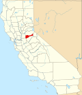
Lower Rancheria is a former gold-mining camp in Amador County, California. It was located on Rancheria Creek 2 miles (3.2 km) east-southeast of Drytown,[2] at an elevation of 1017 feet (310 m). Placer mining began at Lower Rancheria in 1848.[2]
Prior to 1855, the camp at Lower Rancheria was mostly populated by Spanish-speaking miners. On 6 August, 1855 a series of murders were carried out at the camp by a group of Mexicans, who killed five men and one woman, after which they robbed a safe. Following this, three of the Mexicans were hanged, and the Mexican population of the camp were driven away.[3]