Luang Namtha
Capital of Luang Namtha province, Laos
From Wikipedia, the free encyclopedia
Luang Namtha (Luang Nam Tha) (Lao: ມ. ຫລວງນໍ້າທາ; Chinese: 琅南塔) is a district and the capital of Luang Namtha Province in northern Laos. The city lies on the Tha River (Nam Tha). The Luang Namtha Museum is in the town.

Luang Namtha
ຫລວງນໍ້າທາ | |
|---|---|
| Namtha District | |
 | |
  Luang Namtha Location in Laos | |
| Coordinates: 20°57′N 101°24′E | |
| Country |  Laos Laos |
| Admin. division | Luang Namtha Province |
| Population (2015)[1] | |
• Total | 54,100 |
| Time zone | UTC+7 (ICT) |
History
Luang Namtha was previously named Muang Luang Phukha.[2]
From January through May 1962, troops from the Royal Lao Army (RLA) fought the Pathet Lao and People's Army of Vietnam in the Battle of Luang Namtha. The battle ended with the RLA's headlong retreat southward 150 kilometers across the Mekong River.[3]
Climate
| Climate data for Luang Namtha, elevation 552 m (1,811 ft), (1990–2019) | |||||||||||||
|---|---|---|---|---|---|---|---|---|---|---|---|---|---|
| Month | Jan | Feb | Mar | Apr | May | Jun | Jul | Aug | Sep | Oct | Nov | Dec | Year |
| Record high °C (°F) | 33.2 (91.8) |
35.0 (95.0) |
38.2 (100.8) |
39.7 (103.5) |
40.5 (104.9) |
37.3 (99.1) |
36.2 (97.2) |
34.8 (94.6) |
36.4 (97.5) |
35.0 (95.0) |
33.2 (91.8) |
31.3 (88.3) |
40.5 (104.9) |
| Mean daily maximum °C (°F) | 26.2 (79.2) |
28.9 (84.0) |
31.0 (87.8) |
32.3 (90.1) |
31.4 (88.5) |
31.1 (88.0) |
30.0 (86.0) |
30.1 (86.2) |
30.5 (86.9) |
29.6 (85.3) |
27.6 (81.7) |
25.2 (77.4) |
29.5 (85.1) |
| Daily mean °C (°F) | 19.3 (66.7) |
20.5 (68.9) |
22.8 (73.0) |
25.4 (77.7) |
26.2 (79.2) |
27.0 (80.6) |
26.4 (79.5) |
26.4 (79.5) |
26.2 (79.2) |
24.8 (76.6) |
22.0 (71.6) |
19.4 (66.9) |
23.9 (75.0) |
| Mean daily minimum °C (°F) | 12.3 (54.1) |
12.1 (53.8) |
14.6 (58.3) |
18.4 (65.1) |
20.9 (69.6) |
22.8 (73.0) |
22.8 (73.0) |
22.6 (72.7) |
21.8 (71.2) |
19.9 (67.8) |
16.4 (61.5) |
13.6 (56.5) |
18.2 (64.7) |
| Record low °C (°F) | 2.8 (37.0) |
5.4 (41.7) |
6.8 (44.2) |
10.5 (50.9) |
14.5 (58.1) |
13.5 (56.3) |
19.4 (66.9) |
19.8 (67.6) |
14.7 (58.5) |
11.9 (53.4) |
9.5 (49.1) |
0.4 (32.7) |
0.4 (32.7) |
| Average precipitation mm (inches) | 26 (1.0) |
24 (0.9) |
56 (2.2) |
108 (4.3) |
201 (7.9) |
190 (7.5) |
294 (11.6) |
307 (12.1) |
172 (6.8) |
94 (3.7) |
58 (2.3) |
31 (1.2) |
1,561 (61.5) |
| Average relative humidity (%) | 82.7 | 76.0 | 72.3 | 74.4 | 77.0 | 80.4 | 83.4 | 85.1 | 83.6 | 83.1 | 83.0 | 83.3 | 80.4 |
| Mean monthly sunshine hours | 164.3 | 181.1 | 193.5 | 179.3 | 193.7 | 134.3 | 117.0 | 122.8 | 150.7 | 158.8 | 153.8 | 149.6 | 1,898.9 |
| Source 1: Food and Agriculture Organization of the United Nations[4] | |||||||||||||
| Source 2: NOAA (extremes)[5] SeaDelt (humidity and sun 2016–2022)[6] | |||||||||||||
Transport
Road
It is connected by Highway 3 to the Thai border at Houayxay-Chiang Khong (197 km (122 mi)), the Chinese border at Boten-Mengla County (60 km (37 mi)), and the Burmese border at Xieng Kok-Kenglat.[7]
Air
Luang Namtha is served by Louang Namtha Airport, 6 km (3.7 mi) south of the city.
Rail

It has 2 railway stations which served by Boten-Vientiane railway: Nateuy railway station at Nateuy and Boten railway station at Boten.
Gallery

 Day market
 Night market
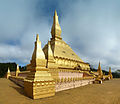 Luang Namtha stupa
 Harvesting rice
 Riverside guesthouse


