Maher, Colorado
From Wikipedia, the free encyclopedia
Maher, Colorado | |
|---|---|
 Maher in 2016, with Mount Lamborn in the distance | |
 Maher  Maher | |
| Coordinates: 38°38′42″N 107°35′05″W / 38.64500°N 107.58472°W | |
| Country | |
| State | |
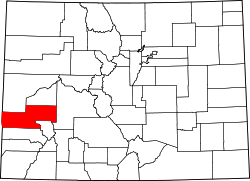
| Counties | Montrose |
| Elevation | 6,808 ft (2,075 m) |
| Time zone | UTC-7 (MST) |
| • Summer (DST) | UTC-6 (MDT) |
| ZIP code[2] | 81415 (Crawford) |
| Area code | 970 |
| GNIS feature ID | 186732[1] |
Maher is an unincorporated community located in Montrose County,[1] Colorado, United States. The U.S. Post Office at Crawford (ZIP Code 81415) now serves Maher postal addresses.[2]