Manchester (village), New York
From Wikipedia, the free encyclopedia
Manchester, New York | |
|---|---|
 Bandstand in the center of the village | |
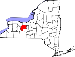
  Manchester, New York Location within the state of New York | |
| Coordinates: 42°58′10″N 77°13′34″W / 42.96944°N 77.22611°W | |
| Country | United States |
| State | New York |
| County | Ontario |
| Area | |
• Total | 1.14 sq mi (2.96 km2) |
| • Land | 1.14 sq mi (2.96 km2) |
| • Water | 0 sq mi (0.00 km2) |
| Elevation | 590 ft (180 m) |
| Population (2020) | |
• Total | 1,640 |
| • Density | 1,437.2/sq mi (554.91/km2) |
| Time zone | UTC-5 (Eastern (EST)) |
| • Summer (DST) | UTC-4 (EDT) |
| ZIP code | 14504 |
| Area code | 585 |
| FIPS code | 36-44853 |
| GNIS feature ID | 0956335 |
| Website | www |
Manchester is a village located within the Town of Manchester in Ontario County, New York, United States. The population was 1,709 at the 2010 census. The village was named after Manchester in England.
The Village of Manchester is located in the southwest part of the town, north of Canandaigua.
- (The area and population reported and analyzed in this article are also included in the aggregate values for the town as a whole. See: Manchester (town), New York. )
The future village was the first settlement in the Town, in 1793. The community was originally called "Coonsville," after one of its early settlers, Valentine Coon, but when manufacturing became important, the name was changed to "Manchester." The village was incorporated in 1892.
Geography
According to the United States Census Bureau, the village has a total area of 1.2 square miles (3.0 km2), all land.
New York State Route 21 passes through the village, which is located immediately south of the New York State Thruway (exit 43) and New York State Route 96.