Manching
From Wikipedia, the free encyclopedia
Manching | |
|---|---|
 Coat of arms | |
Location of Manching within Pfaffenhofen a.d.Ilm district 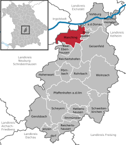 | |
 Manching  Manching | |
| Coordinates: 48°43′7″N 11°29′50″E / 48.71861°N 11.49722°E | |
| Country | Germany |
| State | Bavaria |
| Admin. region | Oberbayern |
| District | Pfaffenhofen a.d.Ilm |
| Government | |
| • Mayor (2020–26) | Herbert Nerb[1] (FW) |
| Area | |
• Total | 35.48 km2 (13.70 sq mi) |
| Elevation | 366 m (1,201 ft) |
| Population (2023-12-31)[2] | |
• Total | 13,083 |
| • Density | 370/km2 (960/sq mi) |
| Time zone | UTC+01:00 (CET) |
| • Summer (DST) | UTC+02:00 (CEST) |
| Postal codes | 85077 |
| Dialling codes | 08459 |
| Vehicle registration | PAF |
| Website | www.manching.de |
Manching (German pronunciation: [ˈmançɪŋ] ⓘ) is a municipality in the district of Pfaffenhofen, in Bavaria, Germany. It is situated on the river Paar, 7 km southeast of Ingolstadt. In the late Iron Age, there was a Celtic settlement, the Oppidum of Manching, on the location of present-day Manching.
Airbus Defence and Space (former Military Air Systems business unit of EADS) has its flight test center here at Manching Airport.
The Barthelmarkt, a well-known beer festival in the area, takes place in the district of Oberstimm on the last weekend of August every year.