Marlene Village, Oregon
From Wikipedia, the free encyclopedia
Marlene Village, Oregon | |
|---|---|
 Village Church in the community | |
  Marlene Village, Oregon  Marlene Village, Oregon | |
| Coordinates: 45°31′02″N 122°49′12″W / 45.51722°N 122.82000°W | |
| Country | United States |
| State | Oregon |
| County | Washington |
| Established | 1949 |
| Elevation | 240 ft (73 m) |
| Time zone | UTC-8 (Pacific (PST)) |
| • Summer (DST) | UTC-7 (PDT) |
| ZIP code | 97005, 97006, 97229 |
| Area codes | 503 and 971 |
| GNIS feature ID | 2812897[1] |
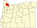
Marlene Village is an unincorporated community in Washington County, Oregon, United States,[1] and within the Portland metropolitan area. As of the 2020 census, Marlene Village had a population of 5,485.[2] It is located immediately northwest of Cedar Hills and south of the Sunset Highway (U.S. 26), lying east and west of Murray Blvd. Marlene Village began as a 400-home "low-cost residential development" on which construction started in early 1949.[3] It was named after Marlene Schnitzer, the then-infant granddaughter of the project's Portland-based developer, Harry Mittleman.[3] The first block of 50 homes went on sale in August 1949.[4] Fire protection and EMS services are provided through Tualatin Valley Fire and Rescue.
.jpg)