Matong
Town in New South Wales, Australia
From Wikipedia, the free encyclopedia
Matong /məˈtɒŋ/ is a town in the central east part of the Riverina region of New South Wales, Australia. The town is 37 kilometres (23 mi) east of Narrandera and 26 kilometres (16 mi) west of Coolamon. At the 2016 census, Matong had a population of 164 people.[2]

Matong | |
|---|---|
The Farmers Home Hotel being rebuilt after a fire | |
 Matong | |
| Coordinates: 34°46′0″S 146°55′0″E | |
| Country | Australia |
| State | New South Wales |
| LGA | |
| Location |
|
| Government | |
| • State electorate | |
| • Federal division | |
| Elevation | 192 m (630 ft) |
| Population | |
| • Total | 159 (SAL 2021)[1] |
| Postcode | 2652 |
| County | Bourke |
Sport
The most popular sport in Matong is Australian rules football, as it lies on the Canola Way, a geographical pocket stretching from Grong Grong and Marrar, in which Australian football retains a strong following, despite New South Wales being a largely rugby league supporting state. The local team, Ganmain-Grong Grong-Matong, plays in the Riverina Football Netball League.
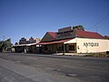
Gallery
 Mechanics Institute
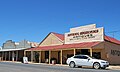 Shop
Shop
 Hotel
Hotel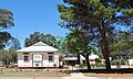 Public School
 Ovals
Ovals Uniting Church


