Millingen aan de Rijn
Town and former municipality in Gelderland, Netherlands
From Wikipedia, the free encyclopedia
Millingen aan de Rijn (Dutch pronunciation: [ˈmɪlɪŋən aːn də ˈrɛin] ⓘ or [-ŋə ʔaːn -]) is a former municipality and a town in the eastern Netherlands, on the border with Germany. It merged into the enlarged municipality of Groesbeek on 1 January 2015, renamed Berg en Dal from 1 January 2016.[3]

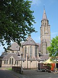 Sint Antonius Church

Millingen aan de Rijn | |
|---|---|
Town and former municipality | |
.JPG) Church in Millingen aan de Rijn | |
 Flag  Coat of arms | |
.svg) Location in Gelderland | |
| Coordinates: 51°52′N 6°3′E | |
| Country | Netherlands |
| Province | Gelderland |
| Municipality | Berg en Dal |
| Area | |
• Total | 10.27 km2 (3.97 sq mi) |
| • Land | 8.66 km2 (3.34 sq mi) |
| • Water | 1.61 km2 (0.62 sq mi) |
| Elevation | 13 m (43 ft) |
| Population (August 2017) | |
• Total | 5,918 |
| Time zone | UTC+1 (CET) |
| • Summer (DST) | UTC+2 (CEST) |
| Postcode | 6566 |
| Area code | 0481 |

