Mingoville, Pennsylvania
From Wikipedia, the free encyclopedia
Mingoville, Pennsylvania | |
|---|---|
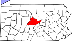
 Map showing Centre County in Pennsylvania | |
  Mingoville Location in Pennsylvania  Mingoville Mingoville (the United States) | |
| Coordinates: 40°55′56″N 77°38′52″W / 40.93222°N 77.64778°W | |
| Country | United States |
| State | Pennsylvania |
| County | Centre |
| Township | Walker |
| Area | |
• Total | 1.83 sq mi (4.74 km2) |
| • Land | 1.83 sq mi (4.74 km2) |
| • Water | 0 sq mi (0.00 km2) |
| Elevation | 1,035 ft (315 m) |
| Population | |
• Total | 527 |
| • Density | 287.8/sq mi (111.12/km2) |
| Time zone | UTC-5 (Eastern (EST)) |
| • Summer (DST) | UTC-4 (EDT) |
| ZIP code | 16856 |
| FIPS code | 42-50104 |
| GNIS feature ID | 1181335 |
Mingoville is an unincorporated community and census-designated place (CDP) in Walker Township, Centre County, Pennsylvania, United States. As of the 2010 census, the population was 503 residents.[3]
Mingoville is located in eastern Centre County, west of the center of Walker Township, in the Nittany Valley between Nittany Mountain to the southeast and Sand Ridge to the northwest. It is 3 miles (5 km) southwest of the community of Hublersburg and 2 miles (3 km) northeast of Zion, along Pennsylvania Route 64. State College is 15 miles (24 km) to the southwest.
Mingoville lies on Logan's Path[4] and was named after Logan, a Cayuga orator affiliated with the Mingo tribe.[5]