Monterey Park, New Mexico
From Wikipedia, the free encyclopedia
CountryUnited States
Elevation5,023 ft (1,531 m)
Monterey Park, New Mexico | |
|---|---|
Census-designated place | |
  Monterey Park, New Mexico | |
| Coordinates: 34°44′56″N 106°39′16″W / 34.74889°N 106.65444°W | |
| Country | United States |
| State | New Mexico |
| County | Valencia |
| Area | |
• Total | 2.64 sq mi (6.85 km2) |
| • Land | 2.64 sq mi (6.85 km2) |
| • Water | 0 sq mi (0.00 km2) |
| Elevation | 5,023 ft (1,531 m) |
| Population | |
• Total | 1,272 |
| • Density | 481/sq mi (185.7/km2) |
| Time zone | UTC-7 (Mountain (MST)) |
| • Summer (DST) | UTC-6 (MDT) |
| GNIS feature ID | 2630011[2] |
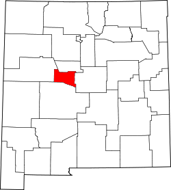
Monterey Park is a census-designated place in Valencia County, New Mexico, United States. As of the 2020 census, Monterey Park had a population of 1,272.[4] It is part of the Albuquerque Metropolitan Statistical Area.
The U.S. Census Bureau previously considered Monterey Park and the neighboring community of El Cerro Mission to be a single CDP, El Cerro-Monterey Park. The CDP was split prior to the 2010 Census.[5]