Natural Dam, Arkansas
From Wikipedia, the free encyclopedia
Natural Dam, Arkansas | |
|---|---|
 Lee Creek and the Natural Dam | |
 Natural Dam, Arkansas  Natural Dam, Arkansas | |
| Coordinates: 35°38′55″N 94°23′41″W / 35.64861°N 94.39472°W | |
| Country | United States |
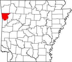
| State | Arkansas |
| County | Crawford |
| Elevation | 663 ft (202 m) |
| Time zone | UTC-6 (Central (CST)) |
| • Summer (DST) | UTC-5 (CDT) |
| ZIP code | 72948 |
| Area code | 479 |
| GNIS feature ID | 72836[1] |
Natural Dam is an unincorporated community in Crawford County, Arkansas, United States. Natural Dam is located on Arkansas Highway 59, 6 miles (9.7 km) north-northwest of Cedarville. Natural Dam has a post office with ZIP code 72948.[2] The now-replaced Lee Creek Bridge, which was listed on the National Register of Historic Places, was located in the community.[3]
The community was named for a natural dam near the original town site.[4]