Nevlingen Peak
From Wikipedia, the free encyclopedia
Elevation2,100 metres (6,900 ft)
LocationEnderby Land
| Nevlingen Peak | |
|---|---|
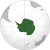
  Nevlingen Peak Location in Antarctica | |
| Highest point | |
| Elevation | 2,100 metres (6,900 ft) |
| Coordinates | 67°59′S 55°05′E / 67.983°S 55.083°E |
| Geography | |
| Location | Enderby Land |
Nevlingen Peak is a 2,100 m tall isolated peak located 13 mi SE of Doggers Nunataks in Enderby Land. It was mapped by Norwegian cartographers from air photos taken by the Lars Christensen Expedition of 1936–37 and was named Nevlingen.[1]