Oberreute
From Wikipedia, the free encyclopedia
Oberreute | |
|---|---|
 Oberreute seen from the east | |
 Coat of arms | |
Location of Oberreute within Lindau district 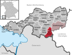 | |
 Oberreute  Oberreute | |
| Coordinates: 47°34′N 9°56′E / 47.567°N 9.933°E | |
| Country | Germany |
| State | Bavaria |
| Admin. region | Schwaben |
| District | Lindau |
| Municipal assoc. | Stiefenhofen |
| Government | |
| • Mayor (2020–26) | Stefan Schneider[1] |
| Area | |
• Total | 13.49 km2 (5.21 sq mi) |
| Highest elevation | 1,041 m (3,415 ft) |
| Lowest elevation | 860 m (2,820 ft) |
| Population (2023-12-31)[2] | |
• Total | 1,702 |
| • Density | 130/km2 (330/sq mi) |
| Time zone | UTC+01:00 (CET) |
| • Summer (DST) | UTC+02:00 (CEST) |
| Postal codes | 88179 |
| Dialling codes | 08387 |
| Vehicle registration | LI |
| Website | www |
Oberreute is a municipality in the district of Lindau in Bavaria in Germany and member of the municipal association of Stiefenhofen. It is an acknowledged air health resort.
Oberreute is located in the Allgäu region, on the border with Austria.
History
The contemporary districts of Stadels and Schönebühl once were seat of a court. Oberreute was not formed until the end of the 18th century. In 1797 the first church was built by inhabitants. The town had been part of the Austrian authority of Bregenz-Hohenegg. Since the signing of the peace treaties of Brünn and Preßburg in 1805 the municipality belongs to Bavaria.
Population development
In 1970 1,040, in 1987 1,283 and in 2000 1,471 inhabitants were living in the municipality of Oberreute.
