Ocean Pointe, Hawaii
From Wikipedia, the free encyclopedia
Ocean Pointe | |
|---|---|
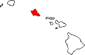
 Approximate location in Honolulu County and the state of Hawaiʻi; this CDP is immediately west of the one highlighted | |
| Coordinates: 21°18′38″N 158°2′11″W / 21.31056°N 158.03639°W | |
| Country | United States |
| State | Hawaiʻi |
| Area | |
• Total | 2.14 sq mi (5.54 km2) |
| • Land | 2.02 sq mi (5.24 km2) |
| • Water | 0.11 sq mi (0.29 km2) |
| Elevation | 16 ft (5 m) |
| Population (2020) | |
• Total | 14,965 |
| • Density | 7,394.2/sq mi (2,854.92/km2) |
| Time zone | UTC−10 (Hawaii–Aleutian) |
| ZIP code | 96706 |
| Area code | 808 |
| FIPS code | 15-56685 |
| GNIS feature ID | 2583427 |
| Website | www |
Ocean Pointe is a housing development and a census-designated place (CDP) located in the ʻEwa District and the City & County of Honolulu on the leeward side of Oʻahu in Hawaiʻi about fifteen miles (24 km) from Honolulu. As of the 2020 census, Ocean Pointe had a population of 14,965.[2] This general area was previously known just as ʻEwa. In the late 19th century to early 20th century, ʻEwa was one of the large population centers on the Island of Oʻahu, with industry focused around sugar cane production. The ʻEwa Mill was a major employer that set up residential villages. Sugar cane is no longer grown on the ʻEwa Plain and Ocean Pointe is now part of Oʻahu's new suburban growth center—an area of substantial sprawl spreading unbroken to the south to ʻEwa Beach, north to Honouliuli, and west to Kalaeloa and Kapolei. This area is now referred to as Oʻahu's Second City, with a city center (downtown) located in Kapolei.
Ocean Pointe is located at 21°18'38" North, 158°2'11" West (21.310556, -158.036389),[3] inland from ʻEwa Beach on the west side of the main thoroughfare, Fort Weaver Road (Hawaii Route 76). This highway runs north past ʻEwa to Waipahu, connecting there to Farrington Highway (State Rte. 90) and the H-1 freeway. A major cross street is Kapolei Parkway, which connects to Kapolei City Center.
More specifically, the CDP is located west of Fort Weaver Road, south of Keaunui Drive, east and south of Essex Road, north of the Pacific Ocean, north of Pupu Place, west of Pupu Street, and north of Papipi Road (not including Papipi Drive, however).[4] According to the United States Census Bureau, the CDP has a total area of 2.14 square miles (5.5 km2), of which 2.03 square miles (5.3 km2) is land and 0.11 square miles (0.28 km2) is covered by water.
Demographics
| Census | Pop. | Note | %± |
|---|---|---|---|
| 2010 | 8,361 | — | |
| 2020 | 14,965 | 79.0% | |
| U.S. Decennial Census[5] | |||
2020 census
As of the 2020 census, Ocean Pointe had a population of 14,965. The median age was 34.5 years. 28.9% of residents were under the age of 18 and 8.1% of residents were 65 years of age or older. For every 100 females there were 97.9 males, and for every 100 females age 18 and over there were 96.7 males age 18 and over.[6][7]
100.0% of residents lived in urban areas, while 0.0% lived in rural areas.[8]
There were 4,512 households in Ocean Pointe, of which 48.9% had children under the age of 18 living in them. Of all households, 75.4% were married-couple households, 9.4% were households with a male householder and no spouse or partner present, and 10.9% were households with a female householder and no spouse or partner present. About 9.6% of all households were made up of individuals and 2.0% had someone living alone who was 65 years of age or older.[6]
There were 4,632 housing units, of which 2.6% were vacant. The homeowner vacancy rate was 0.9% and the rental vacancy rate was 2.1%.[6]
| Race | Number | Percent |
|---|---|---|
| White | 4,240 | 28.3% |
| Black or African American | 882 | 5.9% |
| American Indian and Alaska Native | 82 | 0.5% |
| Asian | 4,741 | 31.7% |
| Native Hawaiian and Other Pacific Islander | 673 | 4.5% |
| Some other race | 374 | 2.5% |
| Two or more races | 3,973 | 26.5% |
| Hispanic or Latino (of any race) | 2,048 | 13.7% |
2010 census
As of the census[9] of 2010, there were 8,361 people, 2,658 households, and 2,194 families residing in the CDP. The population density was 4,118.7 inhabitants per square mile (1,590.2/km2). There were 2,928 housing units at an average density of 1,442.4 per square mile (556.9/km2). The racial makeup of the CDP was 34.6% White, 7.4% African American, 0.6% Native American, 30.5% Asian, 4.1% Pacific Islander, 1.6% from other races, and 21.3% from two or more races. 10.7% of the population are Hispanic or Latino of any race.
There were 2,658 households, out of which 46.8% had children under the age of 18 living with them, 70.0% were married couples living together, 8.5% had a female householder with no husband present, and 17.5% were non-families. 11.7% of all households were made up of individuals, and 1.2% had someone living alone who was 65 years of age or older. The average household size was 3.14 and the average family size was 3.40.
In this CDP, the population was spread out, with 30.2% under the age of 18, 6.9% from 18 to 24, 38.5% from 25 to 44, 19.6% from 45 to 64, and 4.8% who were 65 years of age or older. The median age was 32.1 years. For every 100 females, there were 97.2 males. For every 100 females age 18 and over, there were 97.2 males.