Oostwold, Westerkwartier
Village in Groningen, Netherlands
From Wikipedia, the free encyclopedia
Oostwold (Dutch pronunciation: [ˈoːstʋɔlt]) is a village in the municipality of Westerkwartier in the province of Groningen in the Netherlands.
.jpg)
Oostwold | |
|---|---|
Protestant Church | |
  Oostwold Location on a map of Groningen (province)  Oostwold Oostwold (Netherlands) | |
| Coordinates: 53°12′05″N 06°26′29″E | |
| Country |  Netherlands Netherlands |
| Province |  Groningen Groningen |
| Municipality |  Westerkwartier Westerkwartier |
| Area | |
• Total | 4.36 km2 (1.68 sq mi) |
| Elevation | −0.4 m (−1.3 ft) |
| Population (2021)[1] | |
• Total | 680 |
| • Density | 160/km2 (400/sq mi) |
| Time zone | UTC+1 (CET) |
| • Summer (DST) | UTC+2 (CEST) |
| Postal code | 9828[1] |
| Dialing code | 0597 |
History
The village was first mentioned in 1458 as Oestwolde, and means "eastern woods".[3]
In 1908, the Reformed church was built as a replacement for its medieval predecessor. It was decommissioned in 2004 and in 2005 bought by the restaurant next door for parties, meetings, and congresses.[4]
Oostwold was home to 254 people in 1840.[4]
Gallery
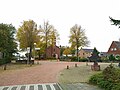 Main street
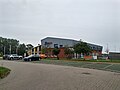 Sports centre
 Former school
.jpg)
.jpg)
.jpg)

