Pefki
Municipal unit in Greece
From Wikipedia, the free encyclopedia
Pefki (Greek: Πεύκη, pronounced [ˈpefci], meaning "pine", before 1959: Μαγκουφάνα Magkoufana[2] [maɡuˈfana]) is a town and a suburb in the northeastern part of the Athens agglomeration, Greece. Since the 2011 local government reform, it is part of the municipality Lykovrysi-Pefki, of which it is the seat and a municipal unit[3] and is part of North Athens regional unit. According to the 2021 population census, Pefki has 21,293 residents.[1]

Pefki
Πεύκη | |
|---|---|
| |
 Location within North Athens regional unit | |
 Pefki | |
| Coordinates: 38°4′N 23°48′E | |
| Country | Greece |
| Administrative region | Attica |
| Regional unit | North Athens |
| Municipality | Lykovrysi-Pefki |
| Area | |
| • Municipal unit | 2.176 km2 (0.840 sq mi) |
| Elevation | 260 m (850 ft) |
| Population (2021)[1] | |
| • Municipal unit | 21,293 |
| • Municipal unit density | 9,785/km2 (25,340/sq mi) |
| Time zone | UTC+2 (EET) |
| • Summer (DST) | UTC+3 (EEST) |
| Postal code | 151 xx |
| Area code | 210 |
| Vehicle registration | Z |
| Website | www.dimospefkis.gr |
Geography
Pefki is situated 10 kilometres (6 miles) northeast of Athens city centre. The municipal unit has an area of 2.176 km2.[4] The built-up area of Pefki is continuous with those of the neighbouring suburbs Irakleio, Lykovrysi, Kifisia and Marousi. Pefki consists of two areas: Ano Pefki and Kato Pefki. Pefki is served by Athens Metro Line 1, with the relevant station called "KAT", named after the KAT Hospital that is nearby, and by several bus routes. The nearest motorway is the A6, south of Pefki.
Historical population
| Year | Population |
|---|---|
| 1981 | 10,863 |
| 1991 | 17,987 |
| 2001 | 19,887 |
| 2011 | 21,353 |
| 2021 | 21,293 |
Education
The Japanese Community School of Athens was previously located in Ano Pefki.[5]
Twin towns
Gallery
 Municipal Stadium of Pefki
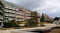 Village of the Sun at Ano Pefki
 Pefki Architecture


