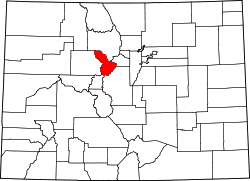
Preston is situated above Gold Run Gulch along Dry Gulch Road. The townsite is now National Forest property and is managed by the Breckenridge Heritage Alliance. About 375 feet (114 m) west of the townsite are the remains of the Jumbo mine–consisting of abandoned minecarts, several mounds of tailings, and a few largely collapsed wooden structures. The remaining Preston town structures are scattered along a short stretch of road.[2] The Jessie mine is located roughly 444 feet (135 m) below Preston and is connected by the road.[3] There is another, unrelated mine named "Jumbo" that operated in the 1910s–roughly 30 years after the opening of the Preston Jumbo mine–near Montezuma several miles to the northeast.[4]
In the summer, the town is accessible by bike, car, and foot. In the winter can be reached by cross-country skis, snowshoes, and fatbike. There are several meadows that provide views of Breckenridge, Frisco, and the Dillon Reservoir. The residential area was part of a connected series of populated mining sites that also included the Prospect Complex to the northeast.[5] A sign for visitors to the Preston townsite displays historic photographs and information, as does a similar sign at the Jessie mine.[3]