Puerto Rico Highway 184
Highway in Puerto Rico
From Wikipedia, the free encyclopedia
Puerto Rico Highway 184 (PR-184) is a main, rural highway that connects Patillas to Cayey, Puerto Rico, with plans to be extended to Cidra. It extends from PR-3 in Cacao Bajo to PR-1 in Beatriz.[3][4]

 PR-3 in Cacao Bajo
 PR-755 in Cacao Bajo
 PR-799 in Cacao Alto
 PR-754 in Mulas
 PR-762 in Quebrada Arriba
 PR-7740 in Muñoz Rivera
 PR-179 in Guavate
 PR-763 in Guavate
 PR-743 in Guavate
 PR-7736 in Beatriz
 PR-52 in Beatriz
Highway 184 | ||||
|---|---|---|---|---|
| Ruta 184 | ||||
| Route information | ||||
| Maintained by Puerto Rico DTPW | ||||
| Length | 33.4 km[1] (20.8 mi) | |||
| Existed | 1953[2]–present | |||
| Major junctions | ||||
| South end | PR-3 in Cacao Bajo | |||
| ||||
| North end |  PR-1 in Beatriz PR-1 in Beatriz | |||
| Location | ||||
| Country | United States | |||
| Territory | Puerto Rico | |||
| Municipalities | Patillas, Guayama, Cayey, Cidra | |||
| Highway system | ||||
| ||||


Route description
Sometimes referred to as Pork Highway, it is the main and only access to the various famous roasted-pork restaurants (lechoneras) in the area of Guavate[5][6] and the access to the Carite State Forest. It borders the Guavate or Carite River, where several people swim often, and like Puerto Rico Highway 181, it borders the man-made Carite Lake, and it meets its end at Puerto Rico Highway 3. The main antennas of the local TV stations Telemundo, WAPA-TV and Univision can be seen from this road in La Santa. The road passes near a point where five municipalities share a border – Cayey, Patillas, San Lorenzo, Caguas and Guayama.[3][4]
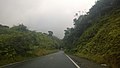 Puerto Rico Highway 184 south in Muñoz Rivera, Patillas
 View from PR-184 in Muñoz Rivera, Patillas
 PR-184 north approaching PR-754 intersection in Mulas, Patillas
 National Guard clearing trees from PR-184 after Hurricane Maria in 2017


.jpg)
Major intersections
| Municipality | Location | km[1] | mi | Destinations | Notes | |||
|---|---|---|---|---|---|---|---|---|
| Patillas | Cacao Bajo | 0.0 | 0.0 | PR-3 – Patillas, Arroyo | Southern terminus of PR-184 | |||
| 1.1 | 0.68 |  PR-755 – Ancones PR-755 – Ancones | ||||||
| Cacao Alto | 2.4– 2.5 | 1.5– 1.6 |  PR-799 – Patillas PR-799 – Patillas | |||||
| Mulas | 7.0 | 4.3 |  PR-754 – Mulas PR-754 – Mulas | |||||
| Quebrada Arriba | 9.9 | 6.2 |  PR-762 – Quebrada Arriba PR-762 – Quebrada Arriba | |||||
| Muñoz Rivera | 19.3 | 12.0 |  PR-7740 (Ruta Panorámica) – San Lorenzo PR-7740 (Ruta Panorámica) – San Lorenzo | Southern terminus of the Ruta Panorámica concurrency | ||||
| Guayama |
No major junctions | |||||||
| Cayey | Guavate | 24.2 | 15.0 |  PR-179 (Ruta Panorámica) – Guayama PR-179 (Ruta Panorámica) – Guayama | Northern terminus of the Ruta Panorámica concurrency | |||
| 27.5– 27.6 | 17.1– 17.1 | PR-7184 – Guavate | Unsigned | |||||
| 27.8– 27.9 | 17.3– 17.3 |  PR-763 – Caguas PR-763 – Caguas | ||||||
| 30.8 | 19.1 |  PR-743 – Vegas PR-743 – Vegas | ||||||
| Beatriz | 32.5 | 20.2 |  PR-7736 – Beatriz PR-7736 – Beatriz | |||||
| 33.1– 33.2 | 20.6– 20.6 |  PR-52 (Autopista Luis A. Ferré) – Caguas, San Juan, Ponce PR-52 (Autopista Luis A. Ferré) – Caguas, San Juan, Ponce | PR-52 exit 32; diamond interchange | |||||
| Cidra | Beatriz | 33.4 | 20.8 | PR-1 – Cayey, Cidra, Caguas | Northern terminus of PR-184 | |||
1.000 mi = 1.609 km; 1.000 km = 0.621 mi
| ||||||||


