Rainbow City, Arizona
From Wikipedia, the free encyclopedia
Rainbow City, Arizona | |
|---|---|
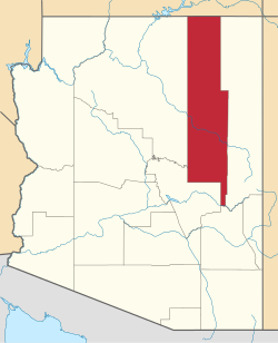
 Location of Rainbow City in Navajo County, Arizona. | |
  Rainbow City, Arizona Location in the United States | |
| Coordinates: 33°52′33″N 109°58′36″W / 33.87583°N 109.97667°W | |
| Country | United States |
| State | Arizona |
| County | Navajo |
| Area | |
• Total | 2.18 sq mi (5.64 km2) |
| • Land | 2.18 sq mi (5.64 km2) |
| • Water | 0 sq mi (0.00 km2) |
| Elevation | 5,781 ft (1,762 m) |
| Population (2020) | |
• Total | 1,001 |
| • Density | 459.7/sq mi (177.51/km2) |
| Time zone | UTC-7 (MST (no DST)) |
| ZIP code | 85941[3] |
| Area code | 928 |
| FIPS code | 04-58620 |
| GNIS feature ID | 2582847[2] |
Rainbow City is a census-designated place (CDP) on the Fort Apache Indian Reservation in Navajo County, Arizona, United States.[2] The population was 968 at the 2010 census.[4][5]