Rastenberg
From Wikipedia, the free encyclopedia
Rastenberg | |
|---|---|
 Coat of arms | |
Location of Rastenberg
within Sömmerda district 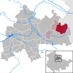 | |
 Location of Rastenberg | |
 Rastenberg  Rastenberg | |
| Coordinates: 51°10′34″N 11°25′9″E / 51.17611°N 11.41917°E | |
| Country | Germany |
| State | Thuringia |
| District | Sömmerda |
| Municipal assoc. | Kölleda |
| Government | |
| • Mayor (2024–30) | Beatrix Winter[1] |
| Area | |
• Total | 35.52 km2 (13.71 sq mi) |
| Elevation | 205 m (673 ft) |
| Population (2023-12-31)[2] | |
• Total | 2,514 |
| • Density | 70.78/km2 (183.3/sq mi) |
| Time zone | UTC+01:00 (CET) |
| • Summer (DST) | UTC+02:00 (CEST) |
| Postal codes | 99636 |
| Dialling codes | 036377 |
| Vehicle registration | SÖM |
| Website | www |
Rastenberg (German pronunciation: [ˈʁastn̩ˌbɛʁk] ⓘ) is a town in the district of Sömmerda, in Thuringia, Germany. It is situated 22 km east of Sömmerda, and 23 km northeast of Weimar.