Ribbonwood, California
From Wikipedia, the free encyclopedia
Elevation1,340 m (4,397 ft)
Ribbonwood
Spring Crest | |
|---|---|
 Ribbonwood, California from Pines to Palms trail | |
  Ribbonwood Location in California  Ribbonwood Ribbonwood (the United States) | |
| Coordinates: 33°34′13″N 116°29′56″W / 33.5703055°N 116.4989043°W | |
| County | Riverside County |
| State | California |
| Country | United States |
| Elevation | 1,340 m (4,397 ft) |
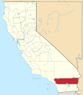
Ribbonwood, is an unincorporated community in Riverside County.[1] It is named after the Ribbonwood tree, Adenostoma sparsifolium, which are prevalent in the area. It is also known as Spring Crest, which is the name of the summit that the community is situated around.