Roerdalen
Municipality in Limburg, Netherlands
From Wikipedia, the free encyclopedia
Roerdalen (Dutch: [ruːrˈdaːlə(n)] ⓘ; Limburgish: Roerdale [ʀuːʀˈdaːlə]) is a municipality in the southeastern Netherlands, in the province of Limburg. As of January 2021, it had about 20580 inhabitants and borders Germany.

Roerdalen
Roerdale | |
|---|---|
Church in Melick | |
 Flag  Coat of arms | |
.svg) Location in Limburg | |
 Roerdalen Location in the Netherlands | |
| Coordinates: 51°9′N 6°0′E | |
| Country | Netherlands |
| Province | Limburg |
| Established | 1 January 1991 |
| Government | |
| • Body | Municipal council |
| • Mayor | Jeffrey van Agtmaal (CDA) |
| Area | |
• Total | 88.79 km2 (34.28 sq mi) |
| • Land | 88.21 km2 (34.06 sq mi) |
| • Water | 0.58 km2 (0.22 sq mi) |
| Elevation | 28 m (92 ft) |
| Population (January 2021)[4] | |
• Total | 20,580 |
| • Density | 233/km2 (600/sq mi) |
| Time zone | UTC+1 (CET) |
| • Summer (DST) | UTC+2 (CEST) |
| Postcode | 6060–6065, 6074–6077 |
| Area code | 0475 |
| Website | www |
Roerdalen is the renaming of the municipality of Melick en Herkenbosch in 1993.
Population centres
- Herkenbosch
- Melick
- Montfort
- Posterholt
- Reutje
- Sint Odiliënberg
- Vlodrop
Topography

Dutch Topographic map of the municipality of Roerdalen, June 2015
Notable people
- Hubert Biermans (1864 in Herkenbosch - 1953) a Dutch and Canadian businessman
- Connie Palmen (born 1955 in Sint Odiliënberg) a Dutch author
- Geert Chatrou (born 1969 in Sint Odiliënberg) a professional whistler
- Jos Verstappen (born 1972 in Montfort) a Dutch former racing driver
- Joeri Verlinden (born 1988 in Melick) a Dutch swimmer, competed at the 2016 Summer Olympics
Gallery
 Windmill (molen van Verbeek) in Sint Odiliënberg
 River Roer
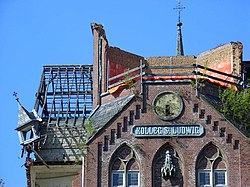 Ruined Building detail of Kolleg St. Ludwig
 Road between St. Odilienberg Paarlo, looking towards St. Odilienberg
 Basiliek van de H.H. Wiro
 Montfort church
 Voorhof
 Sculpture by Nicolas van Ronkenstein
 Montfort former vicarage.
 Montfort former townhall
 Vlodrop
 Church (de Sint Sebastianuskerk) in Herkenbosch


_church.JPG)
_Rijksmonument_30068_De_Voorhof.JPG)
_sculpture_by_Nicolas_van_Ronkenstein.JPG)
_Rijksmonument_47063_pastorie.JPG)


