Rubys Corner, Wisconsin
From Wikipedia, the free encyclopedia
Rubys Corner, Wisconsin | |
|---|---|
 | |
  Rubys Corner, Wisconsin  Rubys Corner, Wisconsin | |
| Coordinates: 45°10′44″N 87°44′23″W / 45.17889°N 87.73972°W | |
| Country |  United States United States |
| State |  Wisconsin Wisconsin |
| County | Marinette |
| Elevation | 634 ft (193 m) |
| Time zone | UTC-6 (Central (CST)) |
| • Summer (DST) | UTC-5 (CDT) |
| Area codes | 715 & 534 |
| GNIS feature ID | 1572708[2] |
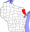
Rubys Corner is an unincorporated community located in the town of Porterfield, Marinette County, Wisconsin, United States.[2][3]
Rubys Corner is located along Wisconsin Highway 180 at the intersection of County Trunk Highway G, at an elevation of 634 feet (193 m).[1] It stands on the right bank of the Menominee River, about 800 feet (240 m) west of the Wisconsin–Michigan state line.[1] It is connected by road to Walsh and Loomis to the west, Marinette to the southeast, and McAllister and Wausaukee to the north. Rubys Corner has a restaurant and a gas station with a convenience store.