Ryan Park, Wyoming
From Wikipedia, the free encyclopedia
Ryan Park, Wyoming | |
|---|---|
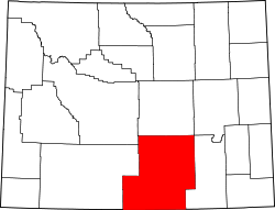
 Location in Carbon County and the state of Wyoming | |
  Ryan Park, Wyoming  Ryan Park, Wyoming | |
| Coordinates: 41°19′17″N 106°30′32″W / 41.32139°N 106.50889°W | |
| Country | United States |
| State | Wyoming |
| County | Carbon |
| Area | |
• Total | 2.1 sq mi (5.4 km2) |
| • Land | 2.1 sq mi (5.4 km2) |
| • Water | 0 sq mi (0.0 km2) |
| Elevation | 8,359 ft (2,548 m) |
| Population | |
• Total | 38 |
| • Density | 18/sq mi (7.0/km2) |
| Time zone | UTC-7 (Mountain (MST)) |
| • Summer (DST) | UTC-6 (MDT) |
| Area code | 307 |
| FIPS code | 56-67670[2] |
| GNIS feature ID | 1602659[3] |
Ryan Park is a census-designated place (CDP) in Carbon County, Wyoming, United States,[3] that is located within the Medicine Bow–Routt National Forest.[4] "Ryan Park" is designated as an acceptable place name by the United States Postal Service for mailing addresses and is assigned the ZIP code (82331) of Saratoga, the nearest incorporated town. The population was 38 at the 2010 census.[1]
Ryan Park Camp is a historical site 1 mile (1.6 km) west of the community of Ryan Park. [5][6][7]
According to the United States Census Bureau, the CDP has a total area of 2.1 square miles (5.4 km2), all land.[1]