Salado, Arkansas
From Wikipedia, the free encyclopedia
Salado, Arkansas | |
|---|---|
 Salado, Arkansas  Salado, Arkansas | |
| Coordinates: 35°41′43″N 91°35′32″W / 35.69528°N 91.59222°W | |
| Country | United States |
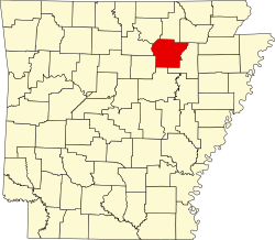
| State | Arkansas |
| County | Independence |
| Elevation | 449 ft (137 m) |
| Population (2020) | |
• Total | 472 |
| Time zone | UTC-6 (Central (CST)) |
| • Summer (DST) | UTC-5 (CDT) |
| GNIS feature ID | 2805683[1] |
Salado is an unincorporated area and census-designated place (CDP) in Independence County, Arkansas, United States.[1] It was first listed as a CDP in the 2020 census with a population of 472.[2]
The Goff Petroglyph Site is located here.[3]
The spur route of Arkansas Highway 14 connects Salado with Southside.[4]