San Miguel District, Lima
From Wikipedia, the free encyclopedia
San Miguel | |
|---|---|
 House of Culture | |
.png) Flag  Coat of arms | |
 Location of San Miguel in the Lima province | |
| Coordinates: 12°4′38″S 77°5′34″W / 12.07722°S 77.09278°W | |
| Country | Peru |
| Region | Lima |
| Province | Lima |
| Founded | October 5, 1920 |
| Government | |
| • Mayor | Eduardo Bless (2023-2026) |
| Area | |
• Total | 10.72 km2 (4.14 sq mi) |
| Population (2023)[1] | |
• Total | 183,597 |
| • Demonym | San miguelino/a |
| Time zone | UTC-5 (PET) |
| UBIGEO | 150136 |
| Website | www |
San Miguel is one of the 43 districts that are part of the Lima province and of the urban area of Lima, Peru. It is bordered by the districts of Bellavista and downtown Lima on the north; Pueblo Libre, Magdalena del Mar and downtown Lima on the east; the Pacific Ocean on the south; and the La Perla district on the west.
San Miguel is an upper-class (65% of its population) and upper-middle class (35%) district with a very high HDI score.[2]
The city's zoo, the parish church of San Miguel,[3] and the Federico Villarreal National University are located in the district.[4]
 Parque de Las Leyendas, the city's zoo
 A view of San Miguel towards the west at sunset
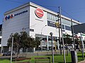 The Wong supermarket, Plaza San Miguel


