Schneizlreuth
From Wikipedia, the free encyclopedia
Schneizlreuth | |
|---|---|
 Saint Vincent Church in Weißbach an der Alpenstraße, municipal part of Schneizlreuth | |
 Coat of arms | |
Location of Schneizlreuth
within Berchtesgadener Land district 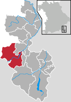 | |
 Location of Schneizlreuth | |
  Schneizlreuth  Schneizlreuth | |
| Coordinates: 47°41′N 12°48′E / 47.683°N 12.800°E | |
| Country | Germany |
| State | Bavaria |
| Admin. region | Oberbayern |
| District | Berchtesgadener Land |
| Government | |
| • Mayor (2020–26) | Wolfgang Simon[1] (FW) |
| Area | |
• Total | 107.28 km2 (41.42 sq mi) |
| Elevation | 511 m (1,677 ft) |
| Population (2023-12-31)[2] | |
• Total | 1,394 |
| • Density | 12.99/km2 (33.65/sq mi) |
| Time zone | UTC+01:00 (CET) |
| • Summer (DST) | UTC+02:00 (CEST) |
| Postal codes | 83458 |
| Dialling codes | 08651, 08665 (Ortsteile Weißbach und Jochberg) |
| Vehicle registration | BGL |
| Website | www.schneizlreuth.de |
Schneizlreuth is a municipality in the district of Berchtesgadener Land in Bavaria in Germany.

