Seabrook, Victoria
Suburb of Melbourne, Victoria, Australia
From Wikipedia, the free encyclopedia
Seabrook is a suburb in Melbourne, Victoria, Australia, 19 km (12 mi) south-west of Melbourne's Central Business District, located within the City of Hobsons Bay local government area. Seabrook recorded a population of 4,952 at the 2021 census.[1]

Seabrook | |||||||||||||
|---|---|---|---|---|---|---|---|---|---|---|---|---|---|
Homestead Run | |||||||||||||
 Seabrook | |||||||||||||
 Interactive map of Seabrook | |||||||||||||
| Coordinates: 37.876°S 144.758°E | |||||||||||||
| Country | Australia | ||||||||||||
| State | Victoria | ||||||||||||
| City | Melbourne | ||||||||||||
| LGA | |||||||||||||
| Location | |||||||||||||
| Government | |||||||||||||
| • State electorate | |||||||||||||
| • Federal division | |||||||||||||
| Area | |||||||||||||
• Total | 1.6 km2 (0.62 sq mi) | ||||||||||||
| Elevation | 11 m (36 ft) | ||||||||||||
| Population | |||||||||||||
| • Total | 4,952 (2021 census)[1] | ||||||||||||
| • Density | 3,095/km2 (8,020/sq mi)[2] | ||||||||||||
| Postcode | 3028 | ||||||||||||
| |||||||||||||
Facilities
The suburb has a small shopping area with some take-away food stores and a Ampol service station located on Point Cook Road and Mintaro Way. Seabrook Primary School also serves the area for education. Although a public school, Seabrook Primary School ranks amongst the top schools in the state of Victoria. Seabrook Primary School has been an International Baccalaureate (IB) World School since September 2011 and it is authorised to offer the IB Primary Years Programme.
Transport
Bus
- Route 496: Laverton Station to Sanctuary Lakes
- Route 498: Laverton Station to Hoppers Crossing station
- Route 944: City to Point Cook (Night Bus Service)
Notable people
- Connor Menadue - AFL player
Gallery
 Seabrook Boulevard
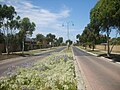 Homestead Run
 Homestead Run Reserve
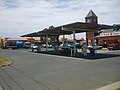 "Hand-e-Food" convenience store and petrol station
 Seabrook Shopping Centre


See also
- City of Werribee – Seabrook was previously within this former local government area.