Sedley, Virginia
From Wikipedia, the free encyclopedia
36°46′34″N 76°59′03″W / 36.77611°N 76.98417°W

Sedley, Virginia
Sedley, Virginia
Sedley, Virginia | |
|---|---|
 Interactive map of Sedley, Virginia | |
| Coordinates: 36°46′34″N 76°59′03″W / 36.776111°N 76.984167°W | |
| Established | 1760's |
| Area | |
| 8.8 km2 (3.4 sq mi) | |
| • Land | 94.8 km2 (36.62 sq mi) |
| • Water | 0.88 km2 (0.34 sq mi) |
| • Rural | 94.8 km2 (36.62 sq mi) |
| Elevation | 27 m (89 ft) |
| Population | |
| 517 | |
• Estimate (2025) | 715 |
| • Density | 5.45/km2 (14.1/sq mi) |
| Time zone | UTC-5 (Eastern (EST)) |
| • Summer (DST) | UTC-4 (EST) |
| ZIP codes | 23878 |
| Area code | 757 |
| GNIS feature ID | 1498305[4] |
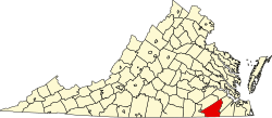
Sedley is an unincorporated community, census-designated place (CDP) in the middle of Southampton County, Virginia, United States. The population as of the 2020 Census was 517. It lies at an elevation of 89 feet (27 m).