Shady Grove, Cherokee County, Texas
From Wikipedia, the free encyclopedia
Shady Grove, Texas | |
|---|---|
  Shady Grove  Shady Grove | |
| Coordinates: 31°50′46″N 95°01′27″W / 31.84611°N 95.02417°W | |
| Country | United States |
| State | Texas |
| County | Cherokee |
| Elevation | 322 ft (98 m) |
| Time zone | UTC-6 (Central (CST)) |
| • Summer (DST) | UTC-5 (CDT) |
| Area codes | 430 & 903 |
| GNIS feature ID | 1379059[1] |
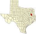
Shady Grove is an unincorporated community in Cherokee County, located in the U.S. state of Texas.[1] According to the Handbook of Texas, the community had a population of 30 in 2000. It is located within the Tyler-Jacksonville combined statistical area.
The area in what is known as Shady Grove today may have been settled sometime after the American Civil War. It had a store and a few scattered houses in the 1930s; in 1936, the population was 20. The store closed after World War II ended. The population remained at 20 in 1990 with a church and some scattered houses. It gained 10 people in 2000.[2]