Sirons Mill, Virginia
From Wikipedia, the free encyclopedia
Sirons Mill, Virginia | |
|---|---|
 Sirons Mill  Sirons Mill | |
| Coordinates: 38°23′51″N 79°28′23″W / 38.39750°N 79.47306°W | |
| Country | United States |
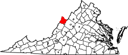
| State | Virginia |
| County | Highland |
| Elevation | 2,454 ft (748 m) |
| Time zone | UTC−5 (Eastern (EST)) |
| • Summer (DST) | UTC−4 (EDT) |
| ZIP code | 24458 |
| Area code | 540 |
| GNIS feature ID | 1493602[1] |
Sirons Mill is an unincorporated community in Highland County, Virginia, United States. Sirons Mill is located 5.9 miles (9.5 km) east of Monterey.[2] The community is situated in the Bullpasture River Valley on Mill Run, a tributary of the Bullpasture River.[3]