Situbondo Regency
Regency in East Java, Indonesia
From Wikipedia, the free encyclopedia
Situbondo Regency (Madurese: Kabhupatèn Situbânḍâ) is a regency (kabupaten) in the east of East Java province, Indonesia. It covers an area of 1,655.05 km2, and had a population of 647,619 at the 2010 Census[2] and 685,967 at the 2020 Census;[3] the official estimate as at mid 2024 was 691,635 (comprising 338,331 males and 353,304 females).[1] It is located towards the eastern end of Java, before Banyuwangi. Its administrative centre is Situbondo, a small town within the regency. One of its famous tourist sites is Baluran National Park.

سيتوبانڎا (Pégon)
ꦱꦶꦠꦸꦧꦤ꧀ꦝ (Hånåcåråkå)
Situbondo Regency
Kabupaten Situbondo | |
|---|---|
| Regional transcription(s) | |
| • Madurese | Situbânḍâ (Latèn) سيتوبۤانڊۤا (Pèghu) ꦯꦶꦠꦸꦨꦤ꧀ꦝ (Carakan) |
| • Javanese | Situbåndhå (Gêdrig) سيتوبانڎا (Pégon) ꦱꦶꦠꦸꦧꦤ꧀ꦝ (Hånåcåråkå) |
 Savannah Bekol | |
 Coat of arms | |
 Location within East Java | |
| Coordinates: 7°42′S 114°00′E | |
| Country | |
| Province | East Java |
| Capital | Situbondo |
| Anniversary | 15 August 1818 |
| Government | |
| • Regent | Yusuf Rio Wahyu Prayogo |
| • Vice Regent | Ulfiyah |
| Area | |
• Total | 1,655.05 km2 (639.02 sq mi) |
| Population (mid 2024 estimate)[1] | |
• Total | 691,635 |
| • Density | 417.894/km2 (1,082.34/sq mi) |
| Time zone | UTC+7 (IWST) |
| Area code | (+62) 338 |
| Website | situbondokab |


Administrative districts
The Regency is divided into seventeen districts (kecamatan), tabulated below with their areas[1] and their population totals from the 2010 Census[2] and the 2020 Census,[3] together with the official estimates as at mid 2024.[1] The table also includes the locations of the district headquarters and the number of administrative villages in each district (totaling 132 rural villages, and 4 urban kelurahan), and its post codes.
| Area Code | Name of District (kecamatan) | Area in km2 | Pop'n Census 2010 | Pop'n Census 2020 | Pop'n Estimate mid 2024 | Admin centre | No. of villages | Post codes |
|---|---|---|---|---|---|---|---|---|
| 35.12.15 | Sumbermalang | 89.65 | 26,319 | 28,466 | 28,906 | Tlogosari | 9 | 68355 |
| 35.12.01 | Jatibanteng | 103.93 | 21,847 | 23,083 | 23,208 | Jatibanteng | 8 | 68357 |
| 35.12.16 | Banyuglugur | 67.04 | 22,443 | 24,583 | 24,181 | Banyuglugur | 7 | 68359 |
| 35.12.02 | Besuki | 27.73 | 61,211 | 65,110 | 66,295 | Besuki | 10 | 68356 |
| 35.12.03 | Suboh | 30.85 | 26,186 | 28,178 | 28,893 | Buduan | 8 | 68354 |
| 35.12.04 | Mlandingan | 54.85 | 22,371 | 23,809 | 24,693 | Mlandingan Kulon | 7 | 68353 |
| 35.12.17 | Bungatan | 68.10 | 24,417 | 25,982 | 26,183 | Bungatan | 7 | 68358 |
| 35.12.05 | Kendit | 111.81 | 28,172 | 29,310 | 30,240 | Kendit | 7 | 68352 |
| 35.12.06 | Panarukan | 60.05 | 53,034 | 58,315 | 59,588 | Wringin Anom | 8 | 68351 |
| 35.12.07 | Situbondo | 28.84 | 46,854 | 48,656 | 49,259 | Patokan | 6 (a) | 68311 - 68316 |
| 35.12.09 | Mangaran | 37.01 | 31,937 | 34,181 | 35,497 | Mangaran | 6 | 68363 |
| 35.12.08 | Panji | 46.46 | 68,286 | 66,926 | 67,723 | Mimbaan | 12 (b) | 68321 - 68323 |
| 35.12.10 | Kapongan | 51.61 | 36,990 | 38,939 | 40,301 | Kesambi Rampak | 10 | 68362 |
| 35.12.11 | Arjasa | 184.82 | 39,708 | 43,637 | 43,769 | Arjasa | 8 | 68371 |
| 35.12.12 | Jangkar | 75.53 | 36,321 | 41,012 | 40,671 | Jangkar | 8 | 68372 |
| 35.12.13 | Asembagus | 225.76 | 47,256 | 49,661 | 50,014 | Asembagus | 10 | 68373 |
| 35.12.14 | Banyuputih (c) | 391.01 | 54,267 | 56,119 | 52,214 | Sumberanyar | 5 | 68374 |
| Totals | 1,655.05 | 647,619 | 685,967 | 691,635 | Situbondo | 136 |
Note: (a) including 2 kelurahan - Dawuhan and Patokan. (b) including 2 kelurahan - Ardirejo and Mimbaan. (c) including the offshore island of Pulau Karangmas.
Climate
Situbondo has a tropical savanna climate (Aw) with heavy rainfall from December to March and moderate to little rainfall from April to November.
| Climate data for Situbondo | |||||||||||||
|---|---|---|---|---|---|---|---|---|---|---|---|---|---|
| Month | Jan | Feb | Mar | Apr | May | Jun | Jul | Aug | Sep | Oct | Nov | Dec | Year |
| Mean daily maximum °C (°F) | 31.1 (88.0) |
31.1 (88.0) |
31.3 (88.3) |
31.7 (89.1) |
31.7 (89.1) |
31.6 (88.9) |
31.5 (88.7) |
31.9 (89.4) |
33.0 (91.4) |
33.6 (92.5) |
33.2 (91.8) |
31.9 (89.4) |
32.0 (89.6) |
| Daily mean °C (°F) | 26.0 (78.8) |
26.0 (78.8) |
26.1 (79.0) |
26.4 (79.5) |
26.3 (79.3) |
25.9 (78.6) |
25.4 (77.7) |
25.8 (78.4) |
26.6 (79.9) |
27.2 (81.0) |
27.2 (81.0) |
26.5 (79.7) |
26.3 (79.3) |
| Mean daily minimum °C (°F) | 20.9 (69.6) |
21.0 (69.8) |
21.0 (69.8) |
21.2 (70.2) |
20.9 (69.6) |
20.2 (68.4) |
19.3 (66.7) |
19.7 (67.5) |
20.2 (68.4) |
20.8 (69.4) |
21.2 (70.2) |
21.1 (70.0) |
20.6 (69.1) |
| Average rainfall mm (inches) | 281 (11.1) |
243 (9.6) |
193 (7.6) |
77 (3.0) |
64 (2.5) |
35 (1.4) |
20 (0.8) |
6 (0.2) |
4 (0.2) |
18 (0.7) |
67 (2.6) |
187 (7.4) |
1,195 (47.1) |
| Source: Climate-Data.org[4] | |||||||||||||
History
Demographics
Languages
Situbondo Madurese is a Madurese dialect spoken mainly in Situbondo Regency, in the eastern salient of Java. This dialect is especially closely related or very close to the Sumenep dialect spoken on the easternmost island of Madura.[5] Situbondo, where this language is spoken, although separated from the island of Madura, most or almost all of its population are Madurese, mainly migrating from Sumenep. Madurese people really dominates all the places there, this can be seen from the fact that in all the districts there the dominant language is Madurese.[6]
Future Projects
Gallery

 Two groups of men under a large banyan tree in Situbondo
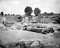 River and washed away bridge in the area of Situbondo


