South Union, South Carolina
From Wikipedia, the free encyclopedia
South Union, South Carolina | |
|---|---|
 South Union  South Union | |
| Coordinates: 34°33′13″N 83°03′03″W / 34.55361°N 83.05083°W[1] | |
| Country | United States |
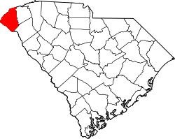
| State | South Carolina |
| County | Oconee |
| Area | |
• Total | 2.62 sq mi (6.79 km2) |
| • Land | 2.60 sq mi (6.74 km2) |
| • Water | 0.015 sq mi (0.04 km2) |
| Elevation | 906 ft (276 m) |
| Population | |
• Total | 341 |
| • Density | 131.0/sq mi (50.57/km2) |
| Time zone | UTC-5 (Eastern (EST)) |
| • Summer (DST) | UTC-4 (EDT) |
| ZIP Codes | |
| Area codes | 864, 821 |
| FIPS code | 45-68210 |
| GNIS feature ID | 2812980[1] |
South Union is an unincorporated community and census-designated place (CDP) in Oconee County, South Carolina, United States. It was first listed as a CDP prior to the 2020 census[1] with a population of 341.[4]
The CDP is in southern Oconee County, bordered to the southwest by the Chickasaw Point CDP. South Carolina Highway 11, the Cherokee Foothills Scenic Highway, runs through South Union, leading south 5 miles (8 km) to South Carolina Exit 1 on Interstate 85. To the north the highway provides access to Westminster, 9 miles (14 km) to the northwest, and Seneca, 14 miles (23 km) to the northeast. South Carolina Highway 182 runs through the east side of South Union, leading southeast 5 miles (8 km) to Fair Play and northeast 4 miles (6 km) to South Carolina Highway 24 at Oakway.