Spencer Dam
From Wikipedia, the free encyclopedia
| Spencer Dam | |
|---|---|
_1.JPG) Spencer Dam in 2010 | |
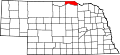
 Location of Spencer Dam in Nebraska  Spencer Dam (the United States) | |
| Country | United States |
| Location | Near Spencer, Nebraska |
| Coordinates | 42°48′32″N 98°39′23″W / 42.8090°N 98.6564°W |
| Purpose | Hydroelectric |
| Status | Failed |
| Opening date | 1927 |
| Demolition date | March 14, 2019 |
| Owner(s) | NPPD |
| Dam and spillways | |
| Type of dam | Buttressed concrete gravity and embankment |
| Impounds | Niobrara River |
| Height (foundation) | 26 ft (7.9 m)[1] |
| Length | 3,698 ft (1,127 m)[1] |
| Reservoir | |
| Total capacity | 16,847 acre⋅ft (20,780,000 m3) (silted)[1] |
| Surface area | 1,200 acres (490 ha)[2] |
| Power station | |
| Commission date | 1927 |
| Decommission date | 2017 |
| Type | Conventional |
| Turbines | 1x 2000 KW 1x 1300 KW |
| Installed capacity | 3300 KW |
| 1996 generation | 14,848,000 KWh[3] |
Spencer Dam was a run of the river hydroelectric dam on the Niobrara River in Boyd County and Holt County, Nebraska, about 5 miles (8.0 km) southeast of Spencer. The dam was operated by the Nebraska Public Power District (NPPD). Heavy precipitation during the March 2019 North American blizzard led to a failure of the dam in the early morning of 14 March, causing heavy flooding downstream.[4]
Initial construction was completed in 1927, at a site located 39 miles (63 km) upstream of the Niobrara's confluence with the Missouri River.[3] The dam was originally 3,698 feet (1,127 m) long and 26 feet (7.9 m) high, constructed in several sections.[1] The powerhouse was located on the north bank of the river, consisting of two Westinghouse generators with capacities of 2000 and 1300 kilowatts.[2] The spillway consisted of four tainter gates and five stoplog gates to the south of the powerhouse. The combined length of the powerhouse and spillway was 404 feet (123 m); the rest of the dam was an earth embankment extending to the south side of the Niobrara valley.[2] The dam originally formed a reservoir with a capacity of 16,847 acre-feet (20,780,000 m3),[3] a normal storage of 5,306 acre-feet (6,545,000 m3),[1] and a surface area of 1,200 acres (490 ha).[2] In 1935 the dam was partially breached after an ice jam broke upstream. It was reconstructed in 1940.[3]
Both after its initial construction and after rebuilding in 1940, the dam was filled with sediment within a few years.[5] Although this did not affect hydropower generation since the dam was operated to match the river flow,[1] twice-annual sluicing had been conducted since 1948 to clear sediment away from the power intakes.[2] The dam gates were opened for about two weeks each year, allowing the river to flow through and wash accumulated sediment downstream.[2] Between 1975 and 1989, fish kills occurred in the Niobrara River that were attributed to sluicing activities. In response, engineers began draining the reservoir more slowly, which has worked in preventing further fish kills.[2]
By 1985, Spencer Dam was the only active hydroelectric plant on the Niobrara River, after the upstream Cornell Dam ceased operation.[1] The NPPD had rights to 1,400,000 acre-feet (1.7×10⁹ m3) of water per year for power generation. As of 2007, the average annual flow through the power plant was 874,000 acre-feet (1.078×10⁹ m3).[3] In 2007, in regards to severe declines in the flow of the Niobrara River as a result of upstream irrigation, NPPD requested that the state of Nebraska make farmers pay as compensation for lost power generation. Several lawsuits were filed as a result, but as of May 2010 all had been decided in favor of NPPD, whose water rights are senior to the irrigators' rights.[3]
In September 2015, NPPD announced that it would be decommissioning the Spencer hydropower plant in 2017 due to increasingly uneconomical cost of power generation at this site. The water rights would be sold for $9 million to the Nebraska Game and Parks Commission and five local natural resources districts to manage the river for agriculture, recreation and wildlife conservation. The dam was planned to remain in place with the gates permanently removed, allowing the river to flow freely through the site.[6]