St. Joseph, Iowa
From Wikipedia, the free encyclopedia
St. Joseph, Iowa | |
|---|---|
 St. Joseph  St. Joseph | |
| Coordinates: 42°54′47″N 94°14′27″W / 42.91306°N 94.24083°W | |
| Country | United States |
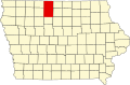
| State | Iowa |
| County | Kossuth |
| Township | Riverdale |
| Area | |
• Total | 0.86 sq mi (2.23 km2) |
| • Land | 0.86 sq mi (2.23 km2) |
| • Water | 0 sq mi (0.00 km2) |
| Elevation | 1,142 ft (348 m) |
| Population (2020) | |
• Total | 51 |
| • Density | 59.2/sq mi (22.85/km2) |
| Time zone | Central (CST) |
| ZIP code | 50519[3] |
| Area code | 515 |
| FIPS code | 19-70005 |
| GNIS feature ID | 2585486[2] |
St. Joseph or Saint Joseph[2] is an unincorporated community and census-designated place (CDP)[4] in Riverdale Township, Kossuth County, Iowa, United States. As of the 2020 census, St. Joseph had a population of 51.[5]
The community is located in southern Kossuth County, in the southeast part of Riverdale Township, 11 miles (18 km) south of Algona along US 169 very close to the Humboldt County line. It is 13 miles (21 km) north of Humboldt via US 169. Iowa Highway 408 leads east from St. Joseph 7 miles (11 km) to Lu Verne.
According to the U.S. Census Bureau, the St. Joseph CDP has an area of 0.85 square miles (2.2 km2), all land.[6] It is bordered to the east by the East Fork of the Des Moines River.