Stittville, New York
From Wikipedia, the free encyclopedia
Stittville, New York | |
|---|---|
Hamlet and CDP | |
  Stittville, New York  Stittville, New York | |
| Coordinates: 43°13′23″N 75°17′18″W / 43.22306°N 75.28833°W | |
| Country | United States |
| State | New York |
| County | Oneida |
| Town | Marcy |
| Area | |
• Total | 0.51 sq mi (1.31 km2) |
| • Land | 0.49 sq mi (1.27 km2) |
| • Water | 0.015 sq mi (0.04 km2) |
| Elevation | 538 ft (164 m) |
| Time zone | UTC-5 (Eastern (EST)) |
| • Summer (DST) | UTC-4 (EDT) |
| ZIP code | 13469 |
| Area codes | 315 & 680 |
| GNIS feature ID | 966461[1] |
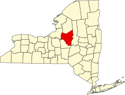
Stittville is a hamlet (and census-designated place)[2] in the town of Marcy in Oneida County, New York, United States. The community is located along New York State Route 291, 9 miles (14 km) north-northwest of Utica. Stittville has a post office with ZIP code 13469.[3][4] As of the 2020 census, Stittville had a population of 294.[5]