Twin Grove, Illinois
From Wikipedia, the free encyclopedia
Twin Grove, Illinois | |
|---|---|
 Twin Grove  Twin Grove | |
| Coordinates: 40°29′36″N 89°04′47″W / 40.49333°N 89.07972°W | |
| Country | United States |
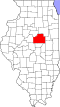
| State | Illinois |
| County | McLean |
| Townships | Dale, Dry Grove |
| Area | |
• Total | 3.97 sq mi (10.29 km2) |
| • Land | 3.97 sq mi (10.27 km2) |
| • Water | 0.0077 sq mi (0.02 km2) |
| Elevation | 817 ft (249 m) |
| Population | |
• Total | 1,524 |
| • Density | 384.5/sq mi (148.46/km2) |
| Time zone | UTC-6 (Central (CST)) |
| • Summer (DST) | UTC-5 (CDT) |
| ZIP Code | 61705 (Bloomington) |
| Area code | 309 |
| GNIS feature ID | 2628561[2] |
| FIPS code | 17-76511 |
Twin Grove is an unincorporated community and census-designated place (CDP) in McLean County, Illinois, United States. As of the 2020 census, Twin Grove had a population of 1,524.[3]
Twin Grove is in western McLean County on both sides of Illinois Route 9. It is 5 miles (8 km) west of Bloomington, the county seat.
According to the U.S. Census Bureau, the Twin Grove CDP has an area of 3.97 square miles (10.28 km2), of which 0.01 square miles (0.03 km2), or 0.25%, are water.[1] Kings Mill Creek flows southward through the western part of the community, leading to the Middle Fork of Sugar Creek, part of the Sangamon River watershed flowing west to the Illinois River.