Untermeitingen
From Wikipedia, the free encyclopedia
Untermeitingen | |
|---|---|
 Church of Saint Stephen | |
 Coat of arms | |
Location of Untermeitingen within Augsburg district 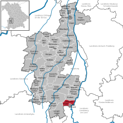 | |
 Untermeitingen  Untermeitingen | |
| Coordinates: 48°10′N 10°48′E / 48.167°N 10.800°E | |
| Country | Germany |
| State | Bavaria |
| Admin. region | Schwaben |
| District | Augsburg |
| Government | |
| • Mayor (2020–26) | Simon Schropp[1] (CSU) |
| Area | |
• Total | 15.58 km2 (6.02 sq mi) |
| Highest elevation | 575 m (1,886 ft) |
| Lowest elevation | 550 m (1,800 ft) |
| Population (2023-12-31)[2] | |
• Total | 7,568 |
| • Density | 490/km2 (1,300/sq mi) |
| Time zone | UTC+01:00 (CET) |
| • Summer (DST) | UTC+02:00 (CEST) |
| Postal codes | 86836 |
| Dialling codes | 08232 |
| Vehicle registration | A |
Untermeitingen is a municipality in the district of Augsburg in Bavaria in Germany.
Untermeitingen is found in the district of Augsburg Untermeitingen which is located in the Lechfeld plain on the left bank of the Lech, 27 km south of Augsburg. The town, located on the border with the district of Landsberg am Lech, forms the administrative area of Lechfeld with the area Klosterlechfeld. Two municipalities together contained 8,795 inhabitants in 2006 over an area of 18 38 km ².
Surrounding communities (starting from the north and in the direction of clockwise): Graben, Scheuring, Obermeitingen, Langerringen and Schwabmünchen.
