Ureterp
Village in Friesland, Netherlands
From Wikipedia, the free encyclopedia
Ureterp (West Frisian: Oerterp) is a village in the municipality of Opsterland in the east of Friesland, the Netherlands. After Gorredijk it is the second largest village of the municipality with a population of around 4,785 in January 2017.[3]

Ureterp
Oerterp | |
|---|---|
Village | |
St Peter's church | |
 Coat of arms | |
 Location in Opsterland municipality | |
 Ureterp Location in the Netherlands  Ureterp Ureterp (Netherlands) | |
| Country | |
| Province | |
| Municipality | |
| Area | |
• Total | 26.24 km2 (10.13 sq mi) |
| Elevation | 5 m (16 ft) |
| Population (2021)[1] | |
• Total | 4,860 |
| • Density | 185/km2 (480/sq mi) |
| Time zone | UTC+1 (CET) |
| • Summer (DST) | UTC+2 (CEST) |
| Postal code | 9247[1] |
| Dialing code | 0512 |
| Website | Official |
History
The village was first mentioned in 1315 as Urathorp, and means "higher settlement". Ura (higher) has been added to distinguish from Olterterp.[4] Ureterp developed in the late middle ages on a sandy ridge. In the 17th century, a second settlement developed at the sluice of the Drachtster Compagnonsvaart. The tower and the north face of Dutch Reformed church are from the 13th century. The church was extensively modified around 1800.[5]
Ureterp was home to 1,512 people in 1840.[6]
Notable people
- Lieuwe de Boer (born 1951), ice speed skater[7]
- Saco Rienk de Boer (1883–1974), landscape architect and city planner[8]
- Grietje Mulder (born 1966), long track speed skater[9]
- Alyda Norbruis (born 1989), Paralympic cyclist[10]
- Jelle Wagenaar (born 1989), footballer[11]
Gallery
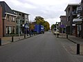 Street of Ureterp
 Modern art in the street
 Fantasy gate
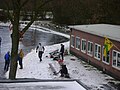 Skating in Ureterp
.jpg)


.jpg)