Villamont, Virginia
From Wikipedia, the free encyclopedia
Villamont, Virginia | |
|---|---|
 Villamont, Virginia  Villamont, Virginia | |
| Coordinates: 37°23′43″N 79°46′34″W / 37.39528°N 79.77611°W | |
| Country | United States |
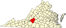
| State | Virginia |
| County | Bedford |
| Elevation | 1,243 ft (379 m) |
| Time zone | UTC−5 (Eastern (EST)) |
| • Summer (DST) | UTC−4 (EDT) |
| ZIP Code | 24064 (Blue Ridge) 24178 (Villamont) |
| Area codes | 540 and 826 |
| GNIS feature ID | 1500259[1] |
Villamont is an unincorporated community in western Bedford County, Virginia, United States. Villamont is located along U.S. Route 460 between Blue Ridge and Montvale. It is part of the Lynchburg Metropolitan Statistical Area.
Government
Villamont had a post office until it closed on January 20, 2007. The ZIP Code for Villamont was 24178.[2][3] Addresses within Villamont now use a Blue Ridge ZIP Code.