Viola, Iowa
From Wikipedia, the free encyclopedia
Viola, Iowa | |
|---|---|
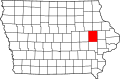
 Viola Location in Iowa  Viola Location in the United States | |
| Coordinates: 42°5′27″N 91°26′16″W / 42.09083°N 91.43778°W | |
| Country | United States |
| State | Iowa |
| County | Linn |
| Township | Brown |
| Elevation | 978 ft (298 m) |
| Time zone | UTC-6 (Central (CST)) |
| • Summer (DST) | UTC-5 (CDT) |
| ZIP codes | 52350 |
| GNIS feature ID | 462581[1] |
Viola is an unincorporated community in eastern Linn County, Iowa, United States. It lies along local roads, northeast of the city of Cedar Rapids, the county seat of Linn County.[2] Its elevation is 978 feet (298 m).[1] Although Viola is unincorporated, it has a post office, with the ZIP code of 52350,[3] which opened on 7 October 1861.[4]