Warder, Netherlands
Village in North Holland, Netherlands
From Wikipedia, the free encyclopedia
Warder is a village in the Dutch province of North Holland. It is a part of the municipality of Edam-Volendam, and lies about 7 km northeast of Purmerend.

Warder | |
|---|---|
Village | |
Former school building | |
 Coat of arms | |
 Warder Location in the Netherlands  Warder Location in the province of North Holland in the Netherlands | |
| Coordinates: 52°35′53″N 5°1′39″E | |
| Country | Netherlands |
| Province | North Holland |
| Municipality | Edam-Volendam |
| Area | |
• Total | 10.82 km2 (4.18 sq mi) |
| Elevation | −1.3 m (−4.3 ft) |
| Population (2021)[1] | |
• Total | 810 |
| • Density | 75/km2 (190/sq mi) |
| Time zone | UTC+1 (CET) |
| • Summer (DST) | UTC+2 (CEST) |
| Postal code | 1473[1] |
| Dialing code | 0299 |
The village was first mentioned between 1130 and 1161 as Werthere, and means "island".[3] The original village was probably more to the east on the former lake Almere and moved inland as the Zuiderzee started to grow.[4] The current Warder developed in the late 12th century as a peat excavation settlement. The elementary school was built as an L-shaped building with tower in 1885. It was renovated around 1920.[5]
Warder was home to 290 people in 1840.[4] It was a separate municipality between 1817 and 1970, when the new municipality of Zeevang was created.[6] In 2016, it became part of the municipality of Edam-Volendam.[4]
Gallery
 The church of Warder
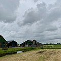 Farm in Warder
 Little shop in the street

.jpg)
.jpg)