Weira
From Wikipedia, the free encyclopedia
Weira | |
|---|---|
 | |
 Coat of arms | |
Location of Weira
within Saale-Orla-Kreis district 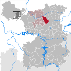 | |
 Location of Weira | |
 Weira  Weira | |
| Coordinates: 50°42′N 11°43′E / 50.700°N 11.717°E | |
| Country | Germany |
| State | Thuringia |
| District | Saale-Orla-Kreis |
| Municipal assoc. | Oppurg |
| Government | |
| • Mayor (2022–28) | Steffen Rogalla[1] |
| Area | |
• Total | 14.88 km2 (5.75 sq mi) |
| Elevation | 390 m (1,280 ft) |
| Population (2023-12-31)[2] | |
• Total | 373 |
| • Density | 25.1/km2 (64.9/sq mi) |
| Time zone | UTC+01:00 (CET) |
| • Summer (DST) | UTC+02:00 (CEST) |
| Postal codes | 07806 |
| Dialling codes | 036481 |
| Vehicle registration | SOK |
Weira (German pronunciation: [ˈvaɪʁa]) is a municipality in the district Saale-Orla-Kreis, in Thuringia, Germany.
Weira was the birthplace of Richard Müller the socialist and industrial unionist active in the German Revolution of 1918.[3]: 11–12
