Westerville, Nebraska
From Wikipedia, the free encyclopedia
Westerville, Nebraska | |
|---|---|
 I.O.O.F. Hall and post office in Westerville | |
 Interactive map of Westerville, Nebraska | |
| Country | United States |
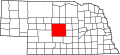
| State | Nebraska |
| County | Custer |
| Area | |
• Total | 0.13 sq mi (0.34 km2) |
| • Land | 0.13 sq mi (0.34 km2) |
| • Water | 0 sq mi (0.00 km2) |
| Elevation | 2,326 ft (709 m) |
| Population (2020) | |
• Total | 31 |
| • Density | 236.3/sq mi (91.22/km2) |
| Time zone | UTC-6 (Central (CST)) |
| • Summer (DST) | UTC-5 (CDT) |
| ZIP code | 68881[3] |
| Area code | 308 |
| FIPS code | 31-52330 |
| GNIS ID | 2583905[2] |
Westerville is an unincorporated community and census-designated place in Custer County, Nebraska, United States. It is located at the intersection of U.S. Route 183 and Nebraska Highway 70. As of the 2020 census, the population was 31.