Wolford, Virginia
From Wikipedia, the free encyclopedia
Wolford, Virginia | |
|---|---|
Unincorporated community | |
 Wolford, Virginia  Wolford, Virginia | |
| Coordinates: 37°21′52″N 81°59′28″W / 37.36444°N 81.99111°W | |
| Country | United States |
| State | Virginia |
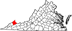
| County | Buchanan |
| Elevation | 1,194 ft (364 m) |
| Time zone | UTC−5 (Eastern (EST)) |
| • Summer (DST) | UTC−4 (EDT) |
| ZIP code | 24658 |
| Area code | 276 |
| GNIS feature ID | 1497221[1] |
Wolford is an unincorporated community in Buchanan County, Virginia, United States. Wolford is 8.4 miles (13.5 km) northeast of Grundy. Wolford has a post office with ZIP code 24658, which opened on August 22, 1949.[2][3] The community was likely named for John Wolford, a pioneer.[4]