Zhanang County
County in Tibet, China
From Wikipedia, the free encyclopedia
Zhanang County or Dranang (Tibetan: གྲ་ནང་རྫོང, Chinese: 扎囊县) is a county of Shannan (Lhokha) in the Tibet Autonomous Region, China. The capital town of county is Dratang town, with a monastery named Dratang.[2]
.jpg)
Zhanang County
扎囊县 • གྲ་ནང་རྫོང་། Dranang, Chanang | |
|---|---|
Zhanang County | |
 Zhanang County Location in Tibet  Zhanang County Zhanang County (China) | |
| Coordinates: 29°27′54″N 91°36′40″E | |
| Country | China |
| Autonomous region | Tibet |
| Prefecture-level city | Shannan (Lhokha) |
| County seat | Dratang |
| Area | |
• Total | 2,141.92 km2 (827.00 sq mi) |
| Population | |
• Total | 36,656 |
| • Density | 17.114/km2 (44.324/sq mi) |
| Time zone | UTC+8 (China Standard) |
| Website | www |
| Zhanang County | |||||||
|---|---|---|---|---|---|---|---|
| Chinese name | |||||||
| Simplified Chinese | 扎囊县 | ||||||
| Traditional Chinese | 扎囊縣 | ||||||
| |||||||
| Tibetan name | |||||||
| Tibetan | གྲ་ནང་རྫོང་། | ||||||
| |||||||
Geography
Dranang County is home to Samye Monastery, the first Buddhist monastery in Tibet, and many other monasteries, including Mindrolling Monastery.
Dranang County is separated into northern and southern parts by the Yarlung Tsangpo River. In 2015, a bridge near Dratang Town was finished, connecting the northern and southern parts of the county.[3]
History
Historically a strategic hub since the Tibetan Empire (7th–9th centuries CE), it served as a cultural and administrative center under the patronage of the Nyingma school of Tibetan Buddhism. The county's name, Dranang, meaning "thorn grove" in Tibetan,[4] reflects its early settlement patterns in the arid valleys.[5]
Zhanang was established as a county in April 1960 following Tibet's democratic reforms, initially under the Lhoka Special Administrative Region. Its boundaries were formalized in 1987, encompassing 5 townships and 3 towns by 2015.[6] A major restructuring in 2021 merged rural townships into urban units, reducing divisions to 3 towns and 2 townships. The county's 2,173 km² area blends agricultural plains with rugged mountains, sustaining barley farming and traditional crafts like Tibetan incense production.[7]
Administrative divisions
Dranang County contains 2 towns and 3 townships.
| Name | Chinese | Hanyu Pinyin | Tibetan | Wylie |
|---|---|---|---|---|
| Towns | ||||
| Dratang Town | 扎塘镇 | Zhātáng zhèn | གྲ་ཐང་གྲོང་རྡལ། | grang thang grong rdal |
| Samye Town | 桑耶镇 | Sāngyē zhèn | བསམ་ཡས་གྲོང་རྡལ། | bsam yas grong rdal |
| Townships | ||||
| Drachi Township | 扎其乡 | Zhāqí xiāng | གྲ་ཕྱི་ཤང་། | gra phyi shang |
| Ngadra Township | 阿扎乡 | Āzhā xiāng | ལྔ་གྲ་ཤང་། | lnga gra shang |
| Gyiru Township | 吉汝乡 | Jírǔ xiāng | དཀྱིལ་རུ་ཤང་། | dkyil ru shang |
Climate
| Climate data for Dranang (1981−2010) | |||||||||||||
|---|---|---|---|---|---|---|---|---|---|---|---|---|---|
| Month | Jan | Feb | Mar | Apr | May | Jun | Jul | Aug | Sep | Oct | Nov | Dec | Year |
| Mean daily maximum °C (°F) | 8.7 (47.7) |
10.7 (51.3) |
14.2 (57.6) |
17.3 (63.1) |
20.9 (69.6) |
24.1 (75.4) |
23.2 (73.8) |
22.0 (71.6) |
20.6 (69.1) |
17.9 (64.2) |
13.1 (55.6) |
9.2 (48.6) |
16.8 (62.3) |
| Daily mean °C (°F) | −0.6 (30.9) |
2.4 (36.3) |
6.4 (43.5) |
9.5 (49.1) |
13.3 (55.9) |
16.7 (62.1) |
16.4 (61.5) |
15.7 (60.3) |
13.9 (57.0) |
9.6 (49.3) |
3.2 (37.8) |
−0.7 (30.7) |
8.8 (47.9) |
| Mean daily minimum °C (°F) | −8.2 (17.2) |
−5.4 (22.3) |
−1.4 (29.5) |
2.3 (36.1) |
6.3 (43.3) |
10.4 (50.7) |
11.3 (52.3) |
11.0 (51.8) |
9.0 (48.2) |
3.4 (38.1) |
−4.2 (24.4) |
−7.9 (17.8) |
2.2 (36.0) |
| Average precipitation mm (inches) | 0.4 (0.02) |
0.3 (0.01) |
1.6 (0.06) |
6.9 (0.27) |
20.3 (0.80) |
49.6 (1.95) |
119.4 (4.70) |
122.5 (4.82) |
66.4 (2.61) |
8.8 (0.35) |
0.4 (0.02) |
0.5 (0.02) |
397.1 (15.63) |
| Average relative humidity (%) | 35 | 29 | 30 | 38 | 44 | 51 | 63 | 67 | 64 | 51 | 43 | 43 | 47 |
| Source: Weather China[8] | |||||||||||||
Gallery
 Samye monastery
 Black stupa of Samye
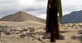 Near Samye monastery
 Yarlung Tsangpo
 Yarlung Tsangpo
 Yarlung Tsangpo


