Al-Hamiz Valley
River in Algiers, Algeria
From Wikipedia, the free encyclopedia
Al-Hamiz Valley is a prominent river in Algiers Province, stretching 54 kilometers to the east of Algiers. Its mouth is located between the municipalities of Bordj El Kiffan and Bordj El Bahri. The river originates from the Tell Atlas and Titteri Mountains near the municipality of Deux Bassins in Médéa Province. It flows through the provinces of Bouira, Blida, Boumerdès, and Algiers before emptying into the Mediterranean Sea.[1]

 Algeria
| Al-Hamiz Valley | |
|---|---|
Affluents de Oued El Harrach | |
 | |
| Location | |
| Country | Algeria |
| Physical characteristics | |
| Source | Tell Atlas, Titteri, Khachna, Médéa Province |
| • elevation | 624 m (2,047 ft; 341 fathoms), Médéa Province, Deux Bassins |
| 2nd source | Tell Atlas, Titteri, Blida Province |
| • elevation | 583 m (1,913 ft; 319 fathoms), Blida Province, Souhane |
| Source confluence | Boumerdès Province, |
| • elevation | 450 m (1,480 ft; 250 fathoms), Larbatache, Khemis El-Khechna, |
| Mouth | Algiers Province, Bordj El Kiffan, Bordj El Bahri |
• elevation | 5 m (16 ft; 2.7 fathoms), Mediterranean Sea |
| Length | 54 Kilometer, Médéa Province, Bouïra Province, Blida Province, Boumerdès Province, Algiers Province |
Basin size | 1,200 km2 (460 sq mi), Drainage basin |
| Basin features | |
| Landmarks | Algeria: Médéa Province: Deux Bassins Bouïra Province: Boukram Blida Province: Souhane, Djebabra Boumerdès Province: Larbatache, Khemis El-Khechna, Hammedi Algiers Province: Dar El Beïda, Rouïba, Bordj El Kiffan, Bordj El Bahri |
Main source
Al-Hamiz Valley originates in the northern part of Deux Bassins municipality, located in Médéa Province. Its source lies at a direct linear distance of 33.68 km (20.93 miles) from its mouth on the Mediterranean coast within Algiers Province. The river’s source is situated in the Tell Atlas and Titteri Mountains, which span the central regions of Médéa, Bouira, Blida, and Boumerdès provinces.[2]
The path
Al-Hamiz Valley flows through five Algerian provinces, crossing various geographical regions, including Titteri, Kabylia, Khachna, and the Mitidja plain.[3]
| Number | Médéa Province | Bouïra Province | Blida Province | Boumerdès Province | Algiers Province |
|---|---|---|---|---|---|
| 01 | Deux Bassins | Boukram | Souhane | Larbatache | Dar El Beïda |
| 02 | Djebabra | Khemis El-Khechna | Rouïba | ||
| 03 | Hammedi | Bordj El Kiffan | |||
| 04 | Bordj El Bahri |
The mouth
The mouth of Al-Hamiz Valley is located between the municipalities of Bordj El Kiffan and Bordj El Bahri in Algiers Province, near the Soumam neighborhood.
The course of the river serves as a natural boundary between these two municipalities, extending to its outlet in the Mediterranean Sea along the Algiers coastline.[4]
Location
The mouth of Al-Hamiz Valley is situated between the municipalities of Bordj El Kiffan and Bordj El Bahri, not far from the mouth of Oued El Harrach and the Sablettes Beach.
Located east of the Oued El Harrach mouth and Sablettes Beach, this area holds a strategic position near the railway connecting El Harrach to Reghaïa.[5] The river's mouth is approximately 20 kilometers east of the Casbah of Algiers, overlooking the Mediterranean Sea. It lies within the territories of Bordj El Kiffan and Bordj El Bahri.[6][7][8][9][10][11][12][13][14]
Gallery
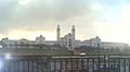 Al-Maqaria train station
 Tamentfoust port
 Affluents de Oued El Harrach
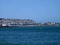 View of the Kasbah from Sablat Beach
 Location of Sablat Beach in Hussein Dey
 View of Sablat Beach from Safir Mosque in Kasbah
 Sablat Beach Water
 Sablat Beach


.svg)
