Attica, Iowa
From Wikipedia, the free encyclopedia
Attica, Iowa | |
|---|---|
 Attica's Water Tower | |
 Attica  Attica | |
| Coordinates: 41°13′47″N 93°00′58″W / 41.22972°N 93.01611°W | |
| Country | United States |
| State | Iowa |
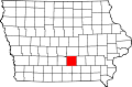
| County | Marion |
| Elevation | 919 ft (280 m) |
| Population | |
• Total | no official census count |
| Time zone | UTC-6 (Central (CST)) |
| • Summer (DST) | UTC-5 (CDT) |
| GNIS feature ID | 454277[1] |
Attica is an unincorporated community in Marion County, Iowa, United States.[1]
It lies approximately 6 mi (9.7 km) south of Knoxville on Iowa Highway 5. A notable landmark around the area is the Hammond Covered Bridge located south of town off of Highway G-76 on 170th.