Tracy, Iowa
From Wikipedia, the free encyclopedia
Tracy, Iowa | |
|---|---|
 Tracy United Methodist Church | |
 Tracy  Tracy | |
| Coordinates: 41°16′35″N 92°52′32″W / 41.27639°N 92.87556°W | |
| Country | United States |
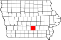
| State | Iowa |
| County | Marion |
| Elevation | 784 ft (239 m) |
| Time zone | UTC-6 (Central (CST)) |
| • Summer (DST) | UTC-5 (CDT) |
| ZIP codes | 50256 |
| GNIS feature ID | 463551 |
Tracy is an unincorporated community in eastern Marion County, Iowa, United States. It lies along local roads east of the city of Knoxville, the county seat of Marion County.[1] Its elevation is 784 feet (239 m).[2] Although Tracy is unincorporated, it has a post office with the ZIP code of 50256,[3] which opened on 31 January 1876.[4]