Avery, Missouri
From Wikipedia, the free encyclopedia
Avery, Missouri | |
|---|---|
 Avery  Avery | |
| Coordinates: 38°04′04″N 93°21′37″W / 38.06778°N 93.36028°W | |
| Country | United States |
| State | Missouri |
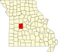
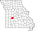
| Counties | Benton and Hickory |
| Elevation | 797 ft (243 m) |
| Time zone | UTC-6 (Central (CST)) |
| • Summer (DST) | UTC-5 (CDT) |
| Area code | 660 |
| GNIS feature ID | 713503[1] |
Avery is an unincorporated community that straddles the boundary between Benton County and Hickory County, Missouri, United States. Avery is located on Supplemental Route B, 8.7 miles (14.0 km) north-northeast of Wheatland.[2][3]
A post office called Avery was established in 1890, moving between businesses in Avery from time to time and thus between counties,[4] remaining in operation until 1897.[5] The community has the name of Henry Avery, a county commissioner.[6]